
 The so-called Google Earth Community must have a lot of cycling fans. They've already composed each stage of the 2006 Tour de France onto Google Earth.
I remember seeing some of these bike race route maps appear midway through last year's Tour, not long after Google Earth was released. The hackers got an earlier start this year and have added lots of features.
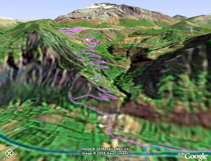
On Stage 15, for instance, the peloton races 187 km through the French countryside from Gap to the famous mountaintop finish at L'Alpe D'Huez (above). The route is clearly marked on the map, and I can use the pan and tilt features to see the terrain the cyclists will pass through.
Also marked are all sprints, all the mountain passes, the departure point and the finishing point, and dozens of points along the way. But the coolest thing is being able to pan down close to the deck and get a good view of the switchbacks heading up the mountain, essentially the same view as a low-flying helicopter. What an awesome climb for the bicyclists.
You can download the entire 2006 Tour de France course at Google Earth Blog. You'll also need a copy of Google Earth on your computer.
Thanks Blue Collar Mountain Biking…
Recent Comments