
 Take it from me; don't poo-poo the bike ride over to Poo Poo Point on Tiger Mountain east of Seattle.
After easily tackling the Chilly Hilly bike ride Sunday on Bainbridge Island, I made the quick decision a couple of days later to pedal my Rockhopper over to the launch point for those paragliders I've seen soaring south of Issaquah.
Quickly checking my Green Trails Map for Tiger Mountain, I saw the trailhead of the old logging road was at 1,400 feet elevation and my destination was 1,780 feet. I should have looked at the route more closely, instead of rushing out of the house. Or, checked with the Evergreen Mountain Bike Alliance wiki for Poo Poo Point.
Steep climbs
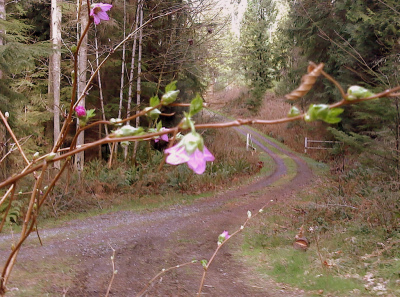 The 7.5 miles of West Side Road has few flat sections and dips to several stream-crossings that contribute to 2,600 feet of elevation gain over the 15-mile route trip. That's essentially the same elevation gain of Chilly Hilly, except at half the distance.
I made it to Poo Poo Point, but I'll admit I was shocked and surprised. I probably would have shouted and cursed the last 2 1/2-mile, 1,000 foot climb from Fifteen Mile Creek to the point if I had the breath. As it was I just took a lesson from my compadres on the Chilly Hilly and got off the bike and hoofed the steepest grades.
Of course the viewpoint was worth the struggle, and I'll do it again when I have the time and a clearer day.
The view
Lake Sammamish looked like a puddle down below. The forested Squak Mountain looked stately from here, and Cougar Mountain rose majestically from the plain. The town of Issaquah looked like a patchwork of roofs down below, and the glass-box high-rises of downtown Bellevue toward the horizon appeared completely insignificant.
I passed a few hikers on the road and at the summit. An old couple and I joked about how long it took us to get to the Point by hiking and biking, then admitted that we were all happy to be able to make the trip in spite of how long it took.
 There weren't any other bike riders on my route. The technical rides on this mountain are closed until April 15, although the logging roads are open year-round.
The mountain was heavily logged beginning in the late 1800s but the loggers left in the 1930s. The area became a state forest in 1980; some logging still goes on here at times.
Getting there
The trailhead is the Tiger Summit turnoff of Route 18, about 4 miles south of I-90. The logging road had no traffic the day I rode it, but the occasional paragliding school shuttle may use it during the summer.
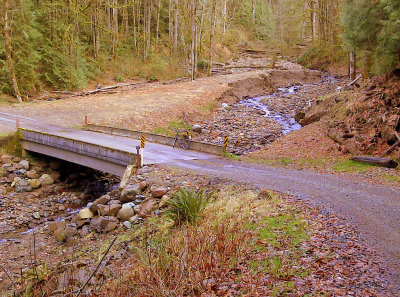
You might be able to catch a glimpse of Mt. Rainier through the trees on the way up. It was cloudy in Rainier's direction on Tuesday, but I don't think it's visible from Poo Poo Point. Another awesome sight is the violent gash cut through the forest by Fifteen Mile Creek, above.
Last year I visited the East Summit of Tiger Mountain for a breath-taking view of Mount Rainier. See “Difficult bicycle climbs have their rewards.”
Recent Comments