
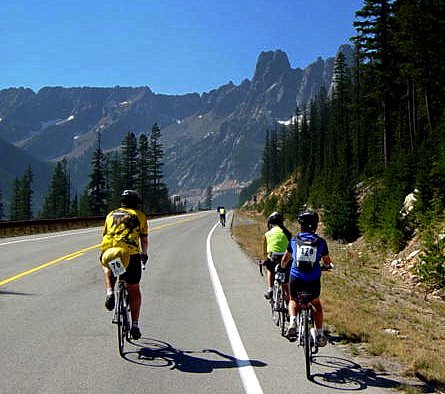
North Cascades Highway
Rumors about the excellent bicycle touring opportunities in my big back yard, the Pacific Northwest, will be confirmed by the latest set of maps published by the Adventure Cycling Association.
The Washington Parks bicycle route is an 870-mile double loop within easy access from Seattle. One loop takes in the Olympic Peninsula in the west. The other climbs over and around the soaring Cascades in the east.
The routes take in three national parks — Olympic, Mt. Rainier, and North Cascade — along with wild ocean views, tranquil islands, steep mountain passes, and orchards and vineyards.
Island hopping
In the west, it island hops on ferries through the San Juan Islands, skirts the Juan de Fuca Strait on the Olympic Discovery Trail, and passes through dense forests. All this time, cyclists can throw it onto the granny-gear and head up into the Olympic National Park.
In the east, the route climbs the passes within sight of the dormant volcano, Mt. Rainier. It then reaches the drier eastern flank of the Cascades, skirting vineyards and orchards before reaching the quirky towns of the Okanogan region. Then it's up and over the North Cascades Highway (the winter closure was lifted May 1), judged one of the most scenic in the nation.

Whale watching; Lopez Island
The two route maps are available as a set or individually. Section 1 is a full loop from Sedro-Woolley to Elma around the Olympic Peninsula. Section 2 is another loop that heads east from Elma over the Cascades to Sedro-Woolley, then uses map No. 1 to complete the loop.
Brilliant terrain
Both maps include roadside services and field notes.
In a press release, routes and mapping director Carla Majernik says:
“These maps cover some of Washington State's most brilliant terrain. They showcase the diversity of the state, its ocean and sounds views in the west, the fertile orchards of the central Columbia Valley, and provide a chance to explore three national parks.”
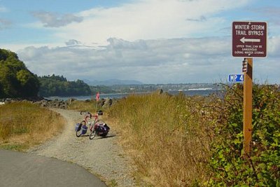
Olympic Discovery Trail
The Washington Parks route brings Adventure Cycling's bicycle route network to 38,080 miles. It started 32 years ago with a 4,000-some mile TransAmerica Route published under the name BikeCentennial.
More maps
Last year, the non-profit completed the Underground Railroad Bicycle Route from Mobile, Alabama, to Owen Sound, Ontario.
It also added three new maps to the website for download: the Adirondack Park Loop (394 miles), the Allegheny Mountains Loop (396 miles) and a Pittsburgh to Erie spur off the Underground Railroad Route (152 miles).
You can find detailed information about the Washington Parks bicycle route at Adventure Cycling.
Recent Comments