
 Is there a way to improve the detailed maps of the passage to the Pacific Coast charted by Lewis & Clark's Corps of Discovery more than two centuries ago?
The Adventure Cycling Association says there is. Five years after printing the first set of Lewis & Clark Trail maps for bicycles, the bike touring organization has reprinted the maps with improvements. The updates include:
— More cycling-friendly routing in places, including off-road bike paths and freshly paved rural roads;
— More accurate elevation profiles;
— Added alternative gravel routes;
— Updates to route services, which now include libraries.
The eight Lewis & Clark Trail map sections now available cover 4,675 miles from Hartford, Illinois, to Seaside, Oregon. The alternative routes the Corps took when it split up on the way home are also included.
Interest in the Lewis & Clark expedition peaked in recent years with the bicentennial of the 1804 to 1806 expedition to discover a Northwest Passage. The Corps travelled up the Missouri River to its source, then down the Columbia River to the Pacific Ocean.
The bicentennial renewed interest in the expedition. Although this is the 201st anniversary, there are still many lasting museums and landmarks along route, as well as events that will be held this year. The Discovering Lewis and Clark website continues to update events that are happening in 2007.
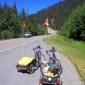
Bicyclists haven't stopped touring on the route, either. Four bike tourists on recumbents are making their way westward. Catch their log — Pedal Pushin' with Lewis & Clark 2007 — at Crazy Guy on a Bike.
If you're looking for more online information, check the Biking Bis Lewis & Clark Trail Resources website.
Picture above from Clarkwheel's photostream at Flickr.com
Recent Comments