
Hood Canal Bridge. 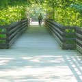 Dungeness River Bridge. Johnson Creek and Morse Creek trestles.
When I biked over to the Olympic Peninsula a few weeks ago for a bicycle-camping trip, it wasn't my intention to recreate a romantic drama like Clint Eastwood's “Bridges of Madison County.”
There's nothing particularly romantic about a sweaty, dusty bicyclist with yesterday's laundry — chamois-side up — fastened to his bike trailer with bungee cords to dry.
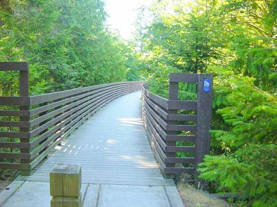
But I did stop to take a few pictures of the bridges I crossed along the way. In the case of the highway bridges, I just needed to stop to settle my nerves after negotiating traffic and bridge decking. On the Olympic Discovery Trail, I wanted to record the old bridges and trestles that carried the defunct Chicago, Milwaukee, St. Paul and Pacific Railroad that has become the existing 30-mile rail-to-trail route.
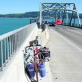 To get there, first I had to cross the infamous Hood Canal Bridge, right. The mile-plus bridge that carries Hwy. 104 between the Kitsap and Olympic peninsulas is dangerous for bicyclists and pedestrians. You must watch out for slick metal grating on the deck and shoulders are non-existent on much of the center portion.
It is being rebuilt with two 12-foot travel lanes with 8-foot shoulders and should be complete sometime in 2009. The Bicycle Alliance of Washington website suggests these precautions: “Take the lane, ride together if a group, and be visible.”
As I was claiming my narrow strip of concrete between bridge grates a car passenger shouted, “Walk your bike!”
Fine, I thought. But where?
There's more info about the Hood Canal Bridge project at the Washington Department of Transportation project website.
 My introduction to the Olympic Discovery Trail was the Johnson Creek Trestle just east of Sequim.
The 410-foot-long bridge is rebuilt from the old railroad trestle that carried trains 86 feet above Johnson Creek from 1915 until about 1985 when the railroad went out of service as the Seattle & North Coast line. Those bushes brushing the sides are actually tree tops rooted along the creekbed below.
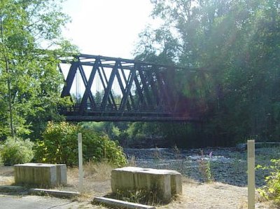 The major bridge on the route is stationed in aptly named Railroad Bridge Park on the western side of Sequim. Also in operation from about 1915 to 1985, a 585-foot-long trestle (at top) leads to the 150-foot timber bridge over the Dungeness River.
For me, this bridge (right) was the most difficult portion of the trip to navigate. The eastern approach is actually a wooden ramp with a couple of hairpin turns. My bicycle touring setup, which included a Yakima trailer, could not make it around those turns with stopping and repositioning several times.
The Park is also the site of the Dungeness River Audobon Center, a museum and interpretive site for the natural history of the northern Olympic Peninsula. The Dungeness River itself is one of the swiftest in the US, falling 7,800 feet in some 35 miles, and a habitat for migrating salmon.
 The last of the spans I crossed was the Morse Creek Trestle, left, converted to public use in 1999. This 400-foot-long old railroad trestle passes just 25 feet above Morris Creek.
There are other short bridges underway for the Olympic Discovery Trail. I spied two or three newly built ones along Highway 101 in the vicinityof Sequim Bay. I learned, however, that they didn't go anywhere yet. That section of the trail isn't open and ends at a chain-link fence surrounding a Fish & Wildlife Service compound. It may open within a year.
Two other bridges for the Olympic Discovery Trail are in the works, at least on the books, west of Port Angeles. Dave LaRoux of the Peninsual Trail Coalition says a 200-foot-long span is needed over Dry Creek and the bridge over the Elwha River needs to be replaced.
Recent Comments